

Introduction
A Study on the Theory and Prior Studies of Idle Space and Station Area
Urban idle space definition
Station area definition
Consideration of Prior Studies
Analysis of the Characteristics of Dongincheon Station and the Distribution of urban Idle Space
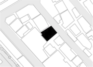
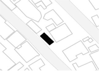
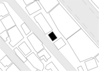
Site Selection and Overview
Status of target site
Target area zone classification
Urban idle spaces distribution status
Causes of urban idle spaces
Conclusions
Introduction
In the process of recent growth and change in Incheon, the old downtown of Incheon rapidly declined as the population movement intensified to Bupyeong, Guwol, Songdo, and Cheongna, along with the decline of the station area, the slump of the station area.
In particular, railways are located in the original city center of Incheon, driving economic growth in the past and connecting the city center and the city center. In addition, in the past, when the population density was small and the size of the city was small, the characteristics of separating regions by ground rail were not a big problem.
Today, however, the old downtown station area remains only a symbol of the past as the regional center of the city due to the overlapping characteristics of the dichotomy of the ground railway and the decline of old downtown. Therefore, since the mid-1990s, old downtown has gradually become a slum, losing its function as the center of the station area, with the population decreasing and the station area changing to Crime-prone Area. Therefore, this study aims to explore the current situation analysis and urban idle spaces and propose ways to utilize them to improve the space in the station area located in old downtown.
This study proposes an improvement plan that can be applied to urban regeneration of old downtown station space by proposing a plan to utilize urban idle spaces centering on low-rise residential areas in the target area of the ‘Dongincheon Station 2030 Reverse Project’, an urban regeneration new project in Incheon.
First, through theoretical and previous studies, concepts related to urban idle space and station influence area were established, and the trends and characteristics of existing research related to urban idle space and station influence area were examined. Next, the distribution status of urban idle space was investigated for low-rise residential areas among the “Dongincheon Station 2030 Reverse Project” areas selected as urban regeneration new deal project areas.
After that, a survey was conducted around Dongincheon Station. The current status survey was analyzed based on the 2030 Incheon Metropolitan City Basic Plan Report, data from the ‘Dongincheon Station 2030 Reverse Project’, and the current status of the target site.
Based on the current status survey of these target sites, the characteristics of Dongincheon Station are analyzed, the analysis plan of urban idle spaces is presented in consideration of the characteristics and status of the station area, and future tasks and implications are derived.
A Study on the Theory and Prior Studies of Idle Space and Station Area
Urban idle space definition
Based on previous studies, Baek Na-young (2003) [1] defined all spaces that are located in cities but not used properly as urban spaces, and Cho Deok-jin (2008) [2] added one more thing to the category of urban expansion or large-scale movement according to urban planning, or empty buildings or spaces created by urban environment changes. In addition, Kim Min-ji (2009) [3] defined that urban idle spaces refer to spaces that are not used for a long time and are not used appropriately in urban spaces and spaces created by urban environment changes by urban planning.
Kim Yeon-jin (2009) [4] said, “urban idle spaces” is a combination of idle and space, and “idle” is interpreted in various meanings depending on academics, but in general, it is a common sense concept based on direct experience, and “urban idle spaces” can be defined as empty. In addition, based on the perspective of ambiguous areas, Oh Joon-gul (2011) [5] defined the abandoned atmosphere as Urban idle spaces, which is a space created by the decline and loss of functions or functions that previously functioned in terms of space continuity.
In previous studies, Kim Hyun-joo (2011) [6] defined the concept of urban spaces as neglected or abandoned space because its function as a space disappeared, but the type of vacation space occupies a part of the urban space but is not used for special purposes, space that is unnecessarily wide or effectively used compared to its use, and space. In addition, Lee Sang-joon (2009) [7] can be found in all urban spatial structures called urban idle spaces. It was defined as a space that was left unattended and abandoned as a space, not an activated space given its function as a space. If parks, squares, roads, and housing complexes are the results of urban planning, transportation islands, lower parts of elevated roads, and spaces between buildings were defined as neglected spaces.
Jung Sung-hee (2016) [8] said that idle space is a combination of idle and space, and the dictionary meaning can be defined as “empty place to tease without use,” and most idle spaces are created by active intervention in urban planning, and are located throughout the city.
Kim Dong-han (2015) [9] states that the urban idle space means a space that is not used or is underused in an urban area, and that the urban idle space can be divided into a neglected space, an unused space, and an underused space. Lee Jung-hye (2018) [10] currently defines it as a space that has the possibility of overcoming decline and becoming a useful space through future regeneration processes, such as loss of use (unused space), lack of use (unused space), or lack of use due to changes in plans and environment.
Recently, the meaning of urban idle spaces is evaluated not only as physically ‘empty space, non-functional space’ but also as a space with potential value that can give new functions. Urban idle space means a space that is unused and neglected, and at the same time has a meaning as a space that potentially implies future utilization. It is a space that has been left as a space in space and has been abandoned for a while due to change of use and transformation, and is reinterpreted as a space that has the possibility of overcoming decline and revitalizing it through the future regeneration process.
Based on the definition of urban idle space, the definition of urban idle space is based on the definition of Lee Jung-hye (2018) and Kim Dong-hwan (2015), and the definition of urban idle space is “currently lost due to changes in plan, insignificance, and lack of space (incheon) or regeneration. These definitions can be summarized as shown in Table 1 below.
Table 1.
Perspective on Urban idle spaces in this study [10]
Station area definition
The definition of the station area can be divided into a generally accepted concept and a legal concept. In general, it is a geographical distance formed around a station, and refers to a range that can be used at maximum in terms of the distance traveled by pedestrians. In addition, it can be seen as a range affected by land use centering on stations.
The most important factor in determining the station area is the distance from the station, and there is no clear definition of the primary station area, but it usually refers to an area within a 500 m radius around the station, which is generally walkable and easy to use subways, railways, and buses. The station area under the Act on the Development and Use of Station Areas stipulates that railway stations and their surrounding areas are constructed and operated under the Railroad Construction Act, the Framework Act on the Development of the Railway Industry, and the Urban Railroad Act. Table 2 below summarizes the definition of such a station area.
Consideration of Prior Studies
Previous studies on urban idle space examined similar concepts such as urban idle space, idle space, idle area, etc., as well as prior studies and legal concepts related to the concept of station influence. In particular, according to the relationship with this study, research on the current status and utilization of urban idle space was mainly reviewed, and additional research on occurrence factors was conducted. Regarding the target site, a review was also conducted on urban regeneration in Incheon, revitalization of the Gyeongin Line in Incheon, and current status analysis. First, research on urban idle spaces has recently emerged in urban regeneration, and research on the current status and concept of urban idle spaces and directions for use and countermeasures are being actively conducted.
Table 2.
The definition of station influence in previous studies
As a result of reviewing previous studies on the causes of urban idle spaces, Kim Yeon-jin (2009) analyzed and analyzed the loss of functions, change of use, absence of functions, limited and temporary. In addition, as a prior analysis of urban idle spaces related to the system, Kim Hyun-joo (2009) suggested the need for commercial and cultural functions and space regeneration using urban idle spaces in the market in parallel with the existing facility improvement project, and Lee Deok-jin (2014) [11] lacks differentiated characteristics from the perspective of urban regeneration in Busan. In addition, it was selected as a factor that it failed to satisfy citizens’ desire for various cultural facilities as it was systematically carried out in a rigid framework led by the government.
As a result of reviewing research on the utilization and alternatives of urban spaces, Hwang Do-won (2008) [12] said that it should be reborn as a complex cultural facility with complex programs to cope with various behavioral situations, and Kim Min-ji (2009) said that space utilization should be actively developed as a landmark. In addition, Lee Sang-joon (2009) said that the regeneration of commercial and cultural functions and spaces using urban idle spaces in the market should be attempted in parallel with the improvement of the existing facility business, while Oh Joon-gul (2011) said that regeneration of idle three-dimensional space is essential to resettle as a part of the city.
Jeong Seong-hee (2016) categorized the urban idle space according to the nature of the space and its main users, presented the utilization plan according to the characteristics of the space, and Choi Jin-wook (2016) [13] said that the economic quality of the urban regeneration was improved.
As a result of reviewing previous studies on how to revitalize the station area and urban regeneration, Cha Ho-cheol (2010) [14] emphasized the importance of specialized urban landscapes, and Shin Ye-kyung (2012) [15] talked about the importance of public transportation, road system, green, and park facilities and suggested a plan. In addition, Lee Byung-dae (2013) [16] said that the development of the station area should be diverse, such as the public sector, the private sector, or the joint government, and related parties from various angles should participate to establish an efficient transportation system, form a systematic urban space structure.
Lim Dong-cheol (2017) [17] said that improvement measures are needed by establishing continuous and realistic policies, maintaining legal and institutional problems, promoting systematic development by project entity, and diversifying goals for organic operation. In addition, Lee Tae-gyu (2018) [18] said that it is necessary to consider physical changes and directions for street maintenance. In addition, Seong Yong-yong (2020) [19] said that more active research on the function of the plaza as a factor that forms a city from the urban planning stage, and surveys and detailed observation surveys on user usage should be conducted at the same time.
An Ji-yeon (2011) [20] suggested the necessity of building an urban landscape and planning the Baedari area to create various events and events, and Lee Jung-won (2012) [21] suggested the direction of urban regeneration through a three-dimensional green network, future-oriented station square, innovative history, three-dimensional movement system, and station area. In addition, Yoon Sung-sik (2016) [22] focused on five factors such as attractiveness, cultural leisure, convenience safety, historical regeneration, and regional specialization in the direction of the Yankee market’s urban regeneration strategy. In addition, Lee Jae-won (2020) [23] analyzed how land use is progressing and which station area is most concentrated in each station area through the use and area of buildings located in the station area.
As a result of examining previous studies on urban idle spaces, research on the current status and response system of urban idle spaces in Korea is actively conducted in urban regeneration, but urban areas in the station area are used as renewable resources.
It was judged that research focusing on the current status and occurrence factors of idle spaces remained in the initial stage. In addition, in the case of urban regeneration systematically conducted at the national level, it is often a rigid project, and it was judged that the participation of main users and citizens and the perspective of experts should be reflected from various angles.
Accordingly, this study differs from previous studies in that it attempted to derive implications for diagnosing urban decline in the old downtown station area in the future by analyzing the current status and characteristics of urban idle spaces in the station area.
Analysis of the Characteristics of Dongincheon Station and the Distribution of urban Idle Space
Site Selection and Overview
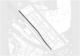
Incheon’s old downtown was formed by the introduction of modern urban functions such as commerce, business, education, religion, culture, and transportation after the opening of Gyeongin Railway in 1899, along with foreign advanced cultural assets such as Byeonginyangyo, Sinmiyangyo, and Ganghwa Island Treaty. Later, in 1908, Dongincheon Station began operating under the name of Chukhyeon Station, and with the revitalization of the Gyeongin Line railroad, the area adjacent to Dongincheon has become the center of Incheon’s economic activities. Since then, markets such as Yankee Market were formed around Nam Plaza in 1945, and the East Incheon Station was created in 1965 to serve as the central square of Incheon.
Afterwards, when the Underground Free Market was registered in 1966, commercial districts were formed around underground shopping malls from Nam Plaza to Dapdong Intersection. In addition, traditional markets such as Songhyeon Market and Baedari were formed, growing into the busiest economic activity center in Incheon as well as citizens. However, before Incheon Metropolitan City Hall, the city hall in Gwan-dong, Jung-gu, Incheon moved to Guwol-dong in 1985, and so-called “famous schools” in East Incheon, including Chukhyeon Elementary School, Park Mun-cho, Incheon Girls’ Middle School, Incheon High School, Songdo High School, and Incheon Girls’ School, were relocated in the 1980s. In addition, since the 1990s, the spatial scope of Incheon-si has continued to expand, and the outflow of population has accelerated due to the development of large-scale residential areas in Guwol, Yeonsu, and Bupyeong.
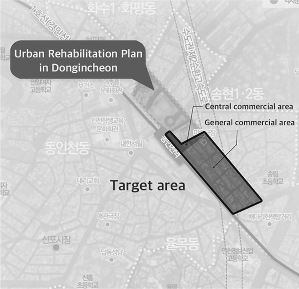
In 1999, a fire incident in an illegal building near Inhyeon-dong caused a lot of casualties, which greatly reduced the commercial district in the Dongincheon area. With these reasons, as it is an old city center with a long history, development projects such as readjustment promotion zones have been promoted since 2007, but as the project is prolonged, it is necessary to prepare an integrated regional revitalization plan. Long-term building restrictions following the designation of the readjustment promotion zone accelerated the aging of buildings and infrastructure, and various measures were sought through the East Incheon Renaissance Project and the Incheon Open Port Creative City Urban Regeneration Plan, but the physical decline continues. Based on this background, the “Dongincheon Station 2030 Reversal Project” was planned, and the main purpose was to establish an urban rehabilitation plan and a district unit plan to support the full-fledged implementation of the New Deal project and regeneration and maintenance of declining areas [24].
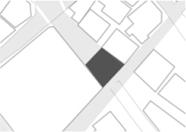
The analysis and implications for the use of urban idle space were derived by selecting a part of the target site for the “Dongincheon Station 2030 Reversal Project” currently planned at the target site. The target site overview can be summarized as shown in Table 3.
Table 3.
Study Site Overview
Status of target site
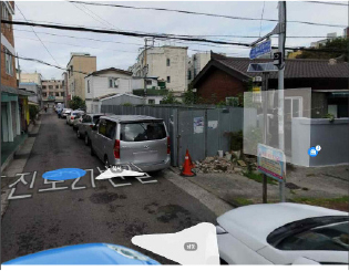
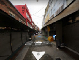
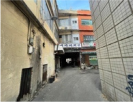
The current target site is largely formed along the Traditional wedding presents street connected along the railroad, the street facing Yankee Market, and the junction area of Hwadojin-ro and Songnim-ro. In the case of the block, which is not directly facing the commercial district, it was formed as a detached house area, and a public parking lot, a state-owned land, is located in the center. In addition, railways pass side by side to the west of Jungang-ro, and the entrance to the old underground shopping mall is located on the lower floor of the Traditional wedding presents street and the corner of Yankee Market, and most of the commercial districts in the mixed street are cotton commercial districts related to hanbok. In addition, Songhyeon Market is located in the direction of Hwadojin-ro, and construction of Dongincheon Station Park Fugio Apartment is underway. In addition, in the direction of Songnim-ro, Baedari Used Bookstore Street in Geumgok-ro, Baedari Underground Shopping Center in Songnim-ro, and Traditional Craft Street are located. Through the current status. Through the current status, it is understood that the characteristics of the target site are divided according to near road, use distribution, and owner.
Target area zone classification
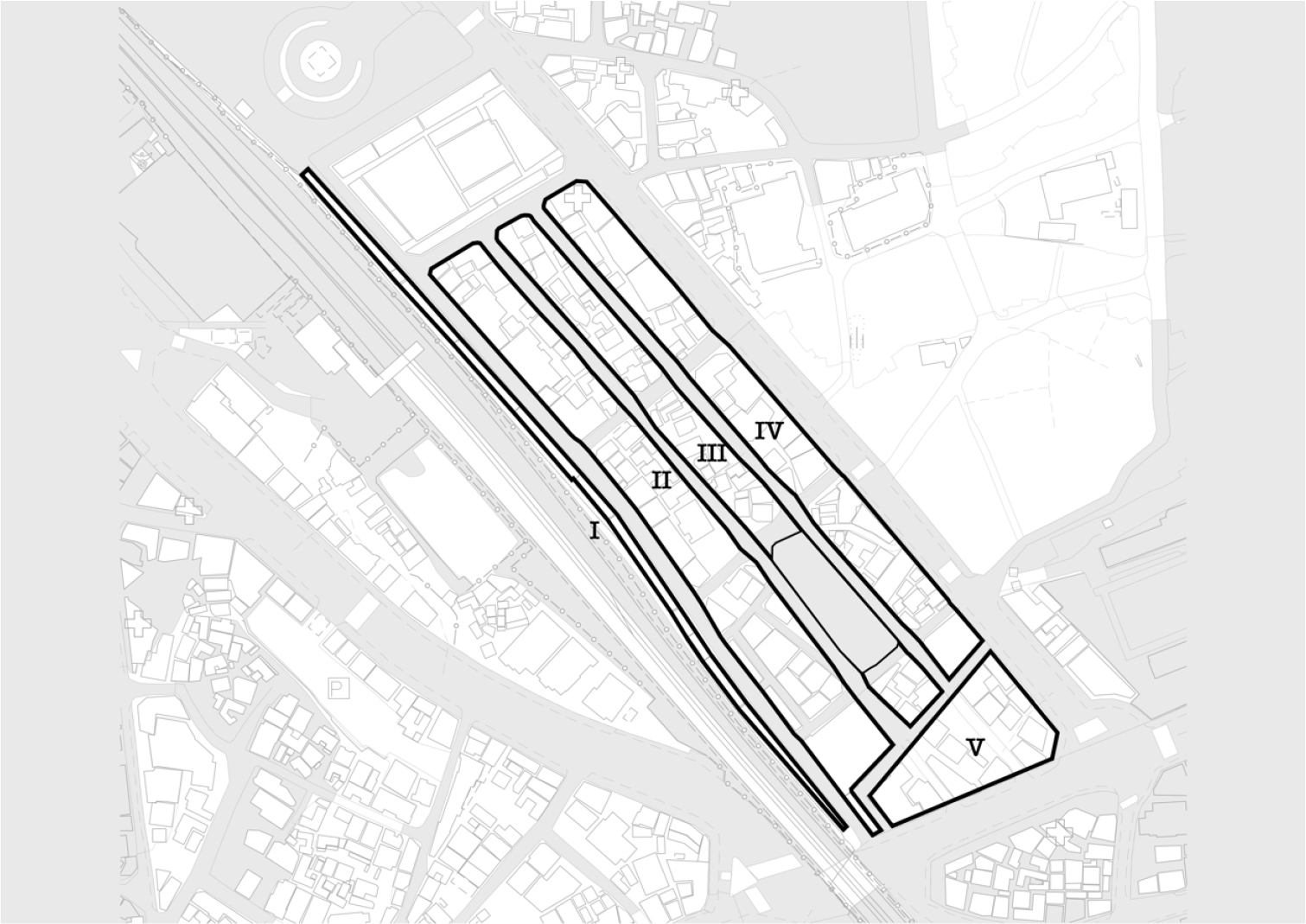
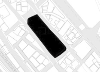
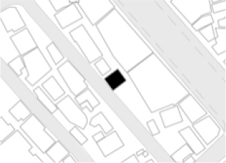
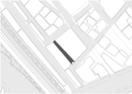
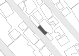
Prior to identifying the characteristics of urban idle spaces in the target area, this study judged that even if urban idle spaces occurred in the same Dongincheon Station area, there would be a difference in the cause and status of urban idle spaces. Therefore, the characteristics were classified based on the current status of Figure 1, and as a result, they were classified into five zones as shown in Table 4.
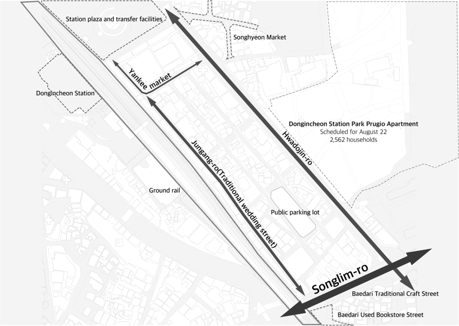
Table 4.
Area Characteristics of Target Areas
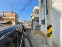
In Area I, neighborhood living facilities are located along Traditional wedding presents street, and behind Traditional wedding presents street, it faces the railroad. The shape of buildings located side by side in a long and narrow form is a building that is often seen in the surrounding area of the ground rail, and is an area that shows the characteristics of the ground rail at the current target site. In addition, as the Traditional wedding presents street is encountered, the official land price is high, and the area is about 2,300 m2. However, due to the decline in industrial and commercial functions of Traditional wedding presents street, the floating population is small, resulting in a decrease in official land prices and poor repair and management of buildings.
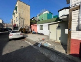
Area II faces an area where detached houses are concentrated while bordering Traditional wedding presents street. In addition, Area II is a mixture of neighborhood living facilities facing Traditional wedding presents street and detached houses facing a densely populated area, and the area is about 9,800 m2. In this area, neighborhood living facilities located in alleys inside blocks that are not directly facing Traditional wedding presents street are severely underdeveloped.
The III areas are densely populated with detached houses, and are long located inside the site through the parking lot site, while surrounding blocks are mixed with neighborhood living facilities, while the total area is about 6,900㎡. In addition, the parking lot sites in the three areas are the only national-owned blocks in the site, bordering Traditional wedding presents street, Hwado-ro block, and detached house block, and the area is about 1,700 m2.
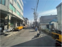
The IV area is the border area of Hwadojin-ro, where Mirim Theater, the only cultural facility in the target area, is located, neighborhood living facilities are arranged along Hwado-ro, and detached houses are arranged behind neighborhood living facilities. In the surrounding area, it is facing Songhyeon Market beyond Hwadojin-ro, and the floating population is expected to increase more than now as a high-rise residential area is being created next to Songhyeon Market. The area of the block is about 6,900 m2 of the target block.
The V area faces Traditional wedding presents street, detached house blocks, Hwadojin-ro, and Songnim-ro, and passes through Songnim-ro to face Incheon Baedari Used Bookstore Street and Baedari Traditional Craft Street. In addition, an underground shopping mall is located between Baedari Used Bookstore Street and VI area, and the area is about 4,000 m2. In addition, the commercial facility area bordering Songnim-ro and Hwado-jin-ro is an area with a high official land price, relatively few old facilities, and belongs to the urban landscape district. The section classification on the map is shown in Figure 2 below.
Urban idle spaces distribution status
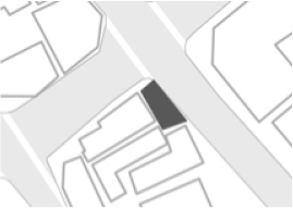
The target site for investigating urban idle spaces is about 42,308 m2 in the urban regeneration activation area, and a total of 17 urban idle spaces in the target area were identified as a result of the first status survey. Urban idle spaces were classified into neglected spaces, unused spaces, and underused spaces, respectively. Each urban idle space was classified into 5 neglected spaces, 6 unused spaces, and 6 low-use spaces. The abandoned space includes abandoned houses, blank lot, and abandoned buildings, and unused spaces belong to spaces of potential value between buildings and roads and buildings, and the low-use space includes spaces of potential value used as parking lots and prefabricated buildings. Based on this, if displayed on the map, idle spaces are distributed as shown in Figure 3.
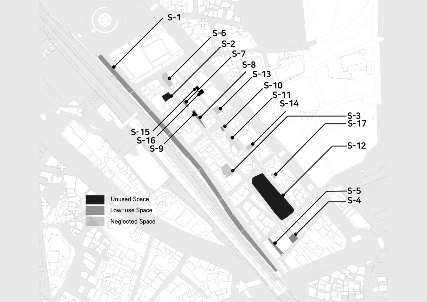
Low-use space
Low-use spaces were classified into parking lots and temporary buildings, and parking lots S-2, S-12 and temporary buildings S-9, S-15, and S-16 are included. S-2 is a dedicated parking lot of Sangjin Sangsa Temple facing the Traditional wedding presents street and has an area of about 60 m2. It is an outdoor parking lot owned by a store and has a size. As a result of visiting and checking the target area in person, it was difficult to efficiently accommodate the number of parking lots because one or two parking lots were parked, and the land was long and long sides were fenced. Table 5 summarizes the outline of low-use spaces.
Table 5.
Urban idle spaces – low-use space

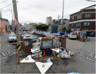
The S-12 is the only state-owned site on the site and is used as a public parking lot, covering an area of 1,700 m2. Currently, it is a space with high potential value with the largest area of urban idle spaces within the site. It is a space that is likely to improve the living area if S-12 is used as an anchor facility in the currently insufficient target area to compensate for the lack of the living area in the target area.
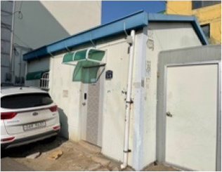
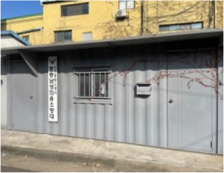
S-9, S-15, and S-16 are temporary buildings that include prefabricated buildings and containers currently in the target site. The S-9 is a prefabricated building built in the middle of a narrow triangular parcel formed according to the shape of the surrounding buildings of the building. Currently, it seems that this building is almost neglected. In the case of S-15 and S-16, it is seen as an external space arbitrarily installed as an external office belonging to Mirim Theater. It is still believed to be in use at Mirim Theater, and two container buildings are arranged side by side.
Unused space
Unused spaces were classified into S-1, S-4, S-5, S-7, S-8, and S-10, as shown in Table 6, and rooftop and unused spaces belong to this. In the case of buildings corresponding to S-1, the obsolescence is severe, most of the spaces are closed or vacant, and there is little separation between buildings and it is characterized by a continuous shape along the road. This form can be seen as a characteristic of the surrounding area due to the division of parcels along the ground railway, and the rooftop space of this type of building was classified as an idle site space considering the characteristics of the target area where the ground railway passes. If the rooftop space of such a building is activated, the commercial area of the lower floor may also be activated. The total area of the rooftop is about 2500 m2.
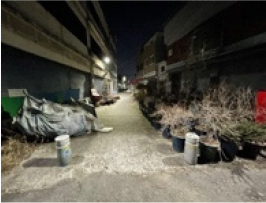
Spaces without use correspond to S-4, S-5, S-7, S-8, and S-10, respectively. In the case of S-4, as a space belonging to the road formed in the three-way space, it forms a wider space than the frequency and use, and in reality, residents are using it as a simple garden with pots, and the area is about 85 m2.
The S-5 space is a lower space of the connected part between the two buildings, where light does not enter and the commercial area declines, damaging the surrounding landscape, and the area is about 140 m. The S-7 is used as a parking lot for buildings facing a lot between buildings. However, it is seen as a space without a clear use and has an area of about 28 m2.
S-8 was formed along the shape of surrounding buildings in a long triangular shape. This type of idle site is judged to be the land created by the remaining form of the land division in the old city center, and the area is about 40 m2. S-9 is an idle space located at the intersection, and some spaces are used as access passages for old buildings in the back, and the area is about 20 m2.
Table 6.
Urban idle spaces – Unused Space

Neglected spaces
The neglected spaces are classified as shown in Table 7, and there are S-3, S-6, S-11, S-13, S-14, and S-17 and waste buildings, vacant lots, and old buildings. S-3 is a building that is judged to be a waste building, and currently has a Warning tape so that the inside of the building cannot be accessed. The exterior is also seriously aged and it seems that rapid renovation is needed. It covers an area of about 310 m².
Table 7.
Urban idle space – Neglected Space
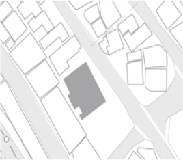
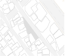
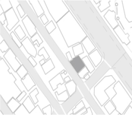
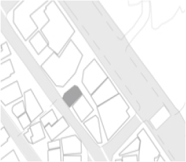
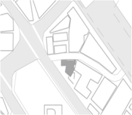
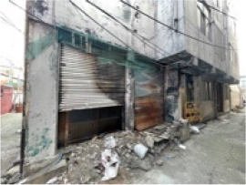

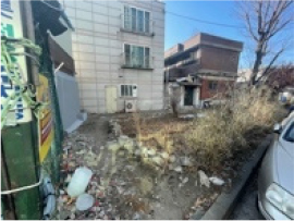
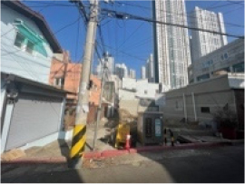
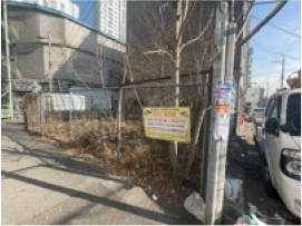
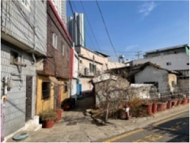
Table 8.
Urban idle space classification
S-6, S-10, S-12, and S-13 appear to be spaces created by the suspension of development as idle sites corresponding to vacant lots, and most of them are steel fences to prevent access from the surrounding area, and garbage is piled up inside, damaging the surrounding beauty. The area is S-6 136 m2, S-11 196 m2, S-13 72 m2, S-13 56 m2 and S-17 63 m2, respectively. The classification of urban idle spaces is divided into unused spaces, low-use spaces, and neglected spaces, and each characteristic and located area are shown in Table 8.
Causes of urban idle spaces
As a result of examining each urban idle space after analyzing the target area, there were three main reasons for the occurrence of urban idle spaces shown in Table 9: economic factors, institutional factors, and physical factors.
In detail, economic factors included the decline of commercial rights and industrial decline, institutional factors included the decline of function and development delay, and physical factors included the aging of buildings and land conditions. Table 8 summarizes this.
Table 9.
Cause of urban idle space
Economic Cause
Economic factors include industrial decline and commercial decline, which includes regional industrial decline such as changes in industrial structure and business relocation, and in the case of commercial decline, regional commercial districts decline due to urban hollowing.
Urban idle spaces, where economic factors worked, were divided into S-1, S-4, and S-5, all of which are urban idle spaces adjacent to the the Traditional wedding presents street.
S-1, S-4, and S-5 have many hanbok-related commercial districts such as cotton fabrics. It is located in the Traditional wedding presents street influenced by the decline of the hanbok-related cotton fabric industry, and was greatly influenced by the decline of the industry.
In addition, S-4, S-5 are not directly facing the Traditional wedding presents street, but they are located in the territory of the commercial district, and along with the decline of the Traditional wedding presents street, the floating population of the subway station decreased.
However, the neighboring commercial facilities near Hwadojin-ro and Songnim-ro, located on the boulevard, were relatively less affected by the decline of commercial rights at Dongincheon Station as they were located on the boulevard with a relatively large floating population.
Institutional Cause
Institutional factors are largely delayed development and deteriorated function. The development delay includes related legal and institutional regulations, development projects, or construction suspension, and in the case of the target site, it was designated as a maintenance area and neglected for a long time. In the case of functional decline, there is an effect due to the functional decline and functional decline of Dongincheon Station, an important infrastructure in the city. S-3, S-6, S-11, S-13, S-14, and S-17, which are vacant lots, abandoned houses, and old buildings, remain vacant due to delays in development and lack of long-term development, resulting in fences and barbed wire to block access.
In particular, it is distributed around District III, a detached housing area. In addition, in the case of S-4, S-5, due to the decline in the function of Dongincheon Station and the decline in the function of Dongincheon Station, the commercial district and the floating population of Dongincheon Station were reduced, and it was affected by the decline.
Physical Cause
Urban idle spaces, which are physical factors, were left unattended without being developed due to damage to the exterior of the building, deterioration, and poor size, shape, and location of the lot.
S-1, S-3, S-5, and S-17 are old and unmanaged buildings among urban idle spaces in the target area that require management or are structurally old buildings. In particular, in the case of the S-3, the aging and appearance damage are serious, and the entrance to the building is blocked by a safety belt, which degrades the surrounding aesthetics and urgently requires improvement. In addition, in the case of S-17, it seems to be a very old building in appearance, and it is a furniture structure that needs renovation. In addition, the idle land corresponding to the land area conditions includes S-7, S-8, S-9, S-10, S-11, S-15, and S-16, and is a space that is neglected or unused because the shape or area of the land is not suitable for building.
Among them, S-10 and S-11 were left unattended as bare land, and it was confirmed that garbage was accumulated and left unattended on the site due to problems such as dumping garbage around the passageway where relatively many residents traveled. The factors of occurrence for each idle site can be summarized in Table 10.
Table 10.
Classification of occurrence factors by idle site
Conclusions
This study attempted to understand the current status and characteristics of urban idle spaces for urban regeneration in the old downtown station area of Incheon, where the Gyeongin Line is located, as the functional decline and decline of old downtown Incheon is a problem. Accordingly, Urban idle spaces were classified into unused spaces, low-use spaces, and neglected spaces for urban renewal New Deal projects around Dongincheon Station, Incheon’s representative old downtown, and factors and characteristics were analyzed through the distribution status of urban idle spaces.
First, urban idle spaces are divided into parking lots, prefabricated buildings, beauty salons, rooftops, abandoned buildings, vacant lots, and old buildings, and parking lots and prefabricated buildings are classified as low-use spaces, and unused spaces. In addition, abandoned buildings and old buildings were classified as abandoned spaces, and the characteristics of each block were investigated through adjacent roads, use distribution, and owner distribution. Most of the buildings facing wedding presents street, Hwado-ro, and Songnim-ro were commercial facilities. Wedding presents street is lined with relatively old buildings and many vacancies are distributed, while the buildings of Songnim-ro and Hwado-jin-ro were well aged and the commercial district was also active. In addition, Mirim Theater, which is classified as the only cultural and assembly facility in the target area, is located in the border area of Hwadojin-ro. It also identified the site of a public parking lot that is considered to be highly likely to be used as the only national land.
Most of the causes of urban idle spaces were land conditions and development delays, which was due to the large distribution of urban idle spaces located in the internal block of the target site. In the detached housing area located inside the block, many vacant lots were distributed due to delay in development. In addition, in the case of vacant lots other than unused spaces, access to the ground and visibility were blocked through aluminum fence, so the surrounding landscape tended to be lowered. In addition, due to the uneven shape of the land, it was difficult to build a building or blank lot within building site was not managed, and most of them were piled up with garbage, which served as an unpleasant factor. In addition, in the case of the surrounding areas of wedding presents street, it was found that the deterioration of buildings was serious and many vacancies were distributed as it was directly affected by the industrial decline. This trend was particularly noticeable as it moved away from Dongincheon Station, and it was simultaneously affected by the decline of commercial rights due to the weakening of the territory due to the deterioration of the function of Dongincheon Station.
This study is meaningful in grasping the distribution pattern of urban idle spaces and analyzing the factors and characteristics of the urban areas that are experiencing decline. However, since the results of this study have limitations in generalizing to specific station areas, in-depth research should be conducted to analyze the characteristic differences between the causes and characteristics of urban idle spaces in the station area in the future.
In addition, the decline of old downtown is spreading, and considering the problems of aging and development delays in the old downtown area, it is necessary to look at the station area from an urban regeneration perspective, and research on the current status, causes, and use of local urban idle spaces is required.
